
Nepal Street View on Google Map: Explore Now
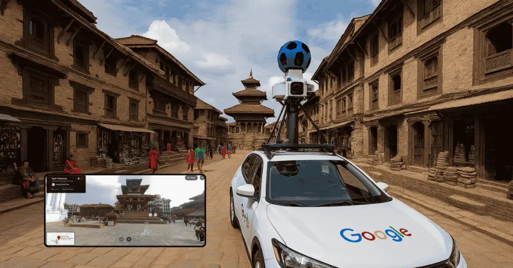
In a groundbreaking move for digital exploration, Google has officially rolled out Street View in Nepal, bringing immersive 360-degree imagery to one of the world’s most captivating destinations. This launch, announced on August 15, 2025, marks a significant expansion beyond the limited Himalayan treks previously available, allowing users worldwide to virtually navigate the bustling streets of Kathmandu, serene Terai plains, and winding Himalayan roads. For tech enthusiasts, travelers, and locals alike, Google Street View Nepal opens up new possibilities for virtual tourism, enhanced navigation, and cultural discovery.
What is Google Street View?
Google Street View is a feature within Google Maps and Google Earth that provides interactive panoramic views from positions along many streets around the world. Since its launch in 2007, it has become an essential tool for navigation, virtual tourism, urban planning, and more. By incorporating Street View, Google has made the world more accessible, especially for people who cannot physically visit certain places.
In the context of Nepal, Street View’s arrival is particularly exciting due to the country’s diverse terrain and rich heritage. Nepal, home to eight of the world’s ten highest peaks including Mount Everest, has long been a bucket-list destination for adventurers. However, physical access can be challenging due to rugged mountains, remote villages, and seasonal weather. Virtual tools like Street View bridge this gap, making Nepal’s wonders accessible to everyone with an internet connection.
Table of Contents
The Journey to Street View in Nepal: From Limited Treks to Nationwide Coverage
Nepal’s Street View story began modestly in 2015 with Google’s “Street View Trek” in the Khumbu region, focusing on the Everest area. Partnering with local legend Apa Sherpa—a 21-time Everest summiter—Google captured imagery of monasteries, schools, and yak pastures using lightweight backpack cameras. This initiative, part of Google’s Earth Outreach program, aimed to preserve cultural sites and promote environmental awareness. At the time, it offered glimpses into sacred valleys and Sherpa communities, but coverage was restricted to trekking paths, leaving urban and lowland areas unexplored.
Fast forward to 2025, and the full rollout represents a massive leap. Google sighted mapping vehicles in Kathmandu as early as June 2024, sparking speculation on platforms like Reddit. After years of anticipation, the service went live on August 15, coinciding with the Digital Nepal Conclave 2025. This expansion includes major cities like Kathmandu, Pokhara, and Biratnagar, as well as the Terai region and select Himalayan highways. Overcoming Nepal’s challenging geography—think high-altitude passes and narrow alleys—required innovative data collection methods, including car-mounted cameras for roads and portable rigs for pedestrian zones.
the project involved deploying advanced camera systems to capture overlapping images, ensuring high-quality panoramas despite the terrain’s demands. This isn’t just about adding Nepal to the map; it’s about integrating it into Google’s global ecosystem, which now covers over 83 countries and more than 10 million miles of roads.
Key Coverage Areas: What You Can Explore Virtually
The initial rollout focuses on Nepal’s urban hubs and scenic routes, providing a comprehensive virtual tour. In Kathmandu, users can stroll through Durbar Square, a UNESCO World Heritage site teeming with ancient temples and intricate carvings. The lively markets of Thamel, known for handicrafts and street food, come alive in 360 degrees, letting you peek into shops selling pashmina shawls or hear the imagined hustle of vendors.
Venturing south, the Terai region offers views of lush plains, national parks like Chitwan, and border towns. Here, Street View captures the natural beauty of subtropical forests and wildlife habitats, ideal for eco-tourism planning. For mountain lovers, winding roads provide breathtaking vistas of snow-capped Himalayas, including glimpses of peaks like Annapurna and Langtang. While not every remote village is covered yet, the service extends to key highways, making it easier to preview treks or road trips.
Google plans ongoing updates, with some images already dated 3-12 months old due to rapid urban development in Nepal. This dynamic approach ensures the content evolves, potentially incorporating user-submitted photospheres in the future.

How It Works
Street View is a feature within Google Maps that provides interactive, 360-degree panoramic images of streets and locations. It allows users to navigate places as if they were physically present. The imagery is captured using specialized camera rigs mounted on vehicles, backpacks, and even drones in some cases.
In Nepal, the challenge of rugged terrain and remote locations was met with innovative solutions. Google previously experimented with capturing the Everest Base Camp using lightweight panoramic rigs. The nationwide rollout now includes broader road coverage across cities and highways.
A Boost for Tourism
Nepal’s tourism industry stands to benefit immensely from this launch. With Street View, potential travelers can preview destinations, plan itineraries, and get a feel for the country’s atmosphere before booking a trip. This is especially valuable for international tourists unfamiliar with Nepal’s geography and cultural landmarks.
The launch aligns with the theme of “Digital Synergy” promoted at the Digital Nepal Conclave. It’s seen as a powerful tool for promoting tourism and cultural preservation.
“This launch is more than just a technological update; it’s a digital gateway to Nepal’s diverse beauty,” wrote Mina Aryal in her coverage of the event.
Cultural Preservation and Education
Beyond tourism, Street View serves as a digital archive of Nepal’s cultural heritage. Ancient temples, historic squares, and traditional neighborhoods are now documented in high-resolution imagery. This can be a valuable resource for educators, historians, and students studying Nepal’s architecture, urban development, and cultural evolution.
It also provides the Nepali diaspora with a way to reconnect with their homeland. Whether it’s revisiting childhood streets or showing family members their heritage, Street View bridges emotional and geographical distances.
Local Businesses and Economic Impact
Local businesses, especially those in hospitality, travel, and retail, can leverage Street View to attract customers. Hotels, restaurants, and tour operators can embed Street View imagery on their websites, giving potential clients a visual preview of their location.
Moreover, small businesses in heritage zones like Bhaktapur and Patan can gain visibility on a global scale. Tourists planning visits can explore nearby shops and eateries, increasing foot traffic and economic activity.
How to Access Street View in Nepal
Accessing Street View in Nepal is simple and works just like it does in any other country:
- On Desktop: Go to Google Maps. Search for a location in Nepal, like “Swayambhunath Stupa.” Drag the yellow “Pegman” icon from the bottom-right corner and drop it onto a blue-highlighted street to enter the immersive view.
- On Mobile (iOS/Android): Open the Google Maps app. Search for a location and drop a pin, or simply tap on a point of interest. If Street View is available, a thumbnail image will appear in the bottom-left corner. Tap it to enter the 360-degree view.
From the Everest Highway to the streets of Bharatpur, a new digital dimension of Nepal is now just a click away. This launch is more than just a technological update; it’s the digital unveiling of a nation, preserving its present for the future and welcoming the entire world to its doorstep.
Nepal Joins the Global Street View Network
With this launch, Nepal joins a growing list of countries with comprehensive Street View coverage. Previously, Nepal appeared in Street View mainly through special projects in the Everest region. The new rollout includes urban centers, highways, and cultural sites across the country.
This expansion reflects Google’s commitment to making the world more accessible and interconnected. It also highlights Nepal’s growing role in the global digital landscape.
Addressing Privacy: A Global Standard in a Local Context
With the introduction of any large-scale data collection technology, questions of privacy are paramount. Google has proactively addressed these concerns by applying its standard, globally-tested privacy protocols in Nepal. This includes the use of automated blurring technology to obscure the faces of pedestrians and the license plates of vehicles, protecting individual identities. Furthermore, Google Maps provides an easily accessible “Report a problem” feature on every image, allowing users to request further blurring of themselves, their children, their homes, or their cars.
Conclusion
The arrival of Google Street View in Nepal is a landmark event that bridges technology and culture. It offers a digital gateway to explore one of the world’s most enchanting countries in unprecedented ways. This innovation not only fuels tourism and business growth but also supports education, smart development, and global connectivity.
As Dr. Anil Rajbhandari aptly sums up:
“Google Street View brings Nepal’s spirit to life online and invites the world to join us on this journey.”
For anyone passionate about technology, travel, or Nepal itself, this development marks an exciting new frontier — and the adventure is just beginning.
For more tech news, subscribe to us.
Last updated on August 17, 2025 at 3:34 pm


